Ancient Map Unveils Possible Final Resting Place of Noah’s Ark
Rev. George Varughese (Shaji Karackal)
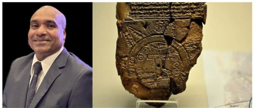
Doğubayazıt, Turkey: In a discovery blending ancient history, archaeology, and faith, scholars have uncovered remarkable new insights from one of the world’s oldest known maps — a 2,700- to 3,000-year-old Babylonian clay tablet known as the Imago Mundi (Babylonian Map of the World), housed in the British Museum. This centuries-old artifact, inscribed with cuneiform script, doesn’t just show a flat-earth view of the ancient world centered on Babylon. On its reverse side and accompanying text, it provides directions to a distant mountainous region called Urartu — the very same area the Bible identifies as Ararat, where Noah’s Ark came to rest after the Great Flood.
Experts, including British Museum curator Dr. Irving Finkel, a leading authority on cuneiform, note that the map references a great flood survivor and his vessel — echoing not only the biblical account of Noah but also earlier Mesopotamian stories like that of Ziusudra or Utnapishtim. The tablet appears to guide readers toward the mountains where this legendary ark landed.
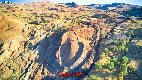
This revelation has excited both historians and believers because it aligns closely with Genesis 8:4, which states: “And the ark rested upon the mountains of Ararat.” Urartu is the ancient Assyrian/Babylonian name for the kingdom that included the region of modern-day eastern Turkey, near Mount Ararat. Many researchers see this as powerful ancient confirmation pointing toward sites like the boat-shaped Durupınar formation in eastern Turkey — a location long studied for its remarkable dimensions matching the biblical description of the Ark.
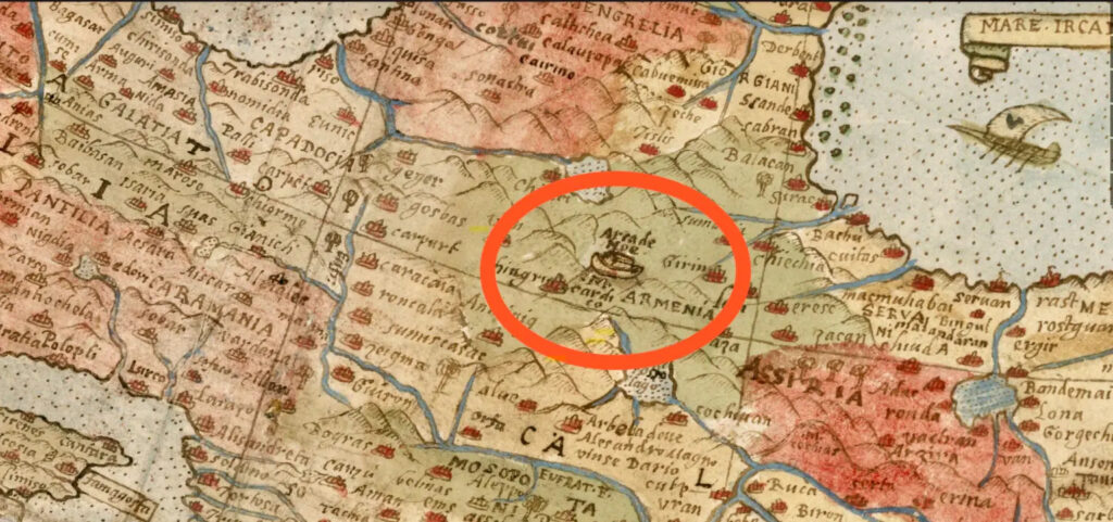
Independent researcher Jimmy Corsetti (known as Bright Insight) has highlighted this discovery. He notes that the Babylonians, who recorded a great flood story centuries before the Bible, treated it as real history and even marked the ark’s final resting place on their map. Corsetti believes this strongly supports the idea that the ark landed in eastern Turkey near Mount Ararat, possibly at the boat-shaped Durupınar site.
For people of faith, this discovery feels deeply inspiring. It suggests that the story of the Flood and God’s deliverance of Noah’s family was not just preserved in Hebrew Scriptures but remembered across ancient cultures and even etched into one of humanity’s earliest attempts at mapping the world. While mainstream archaeology continues to debate the physical remains of the Ark, this ancient map adds another layer of historical intrigue — showing that people thousands of years ago were still talking about, and even mapping directions to, the place where the great vessel came to rest. As more analysis continues, the Imago Mundi stands as a quiet but powerful witness: an old clay tablet, baked in the fires of antiquity, still whispering across the centuries that the greatest survival story ever told may have left its mark not only in sacred texts… but on an ancient map as well.